
The Qhapaq Ñan was one of the greatest infrastructure achievements of the ancient world. Spanning thousands of miles across mountains, deserts, valleys, forests, and high plains, this vast Inca road network connected communities across the Andes and helped hold together one of the largest empires in pre-Columbian history.
Often described as the Inca road system, the Qhapaq Ñan was much more than a set of paths. It functioned as a political tool, a communications network, a trade corridor, a military route, a sacred landscape, and a symbol of imperial power all at once. When people ask why was the Inca road system important, the answer begins with its scale but becomes even more impressive when considering how carefully it was engineered and how deeply it shaped Andean life.
Today, sections of the Qhapaq Ñan Andean Road System are recognized among the world’s most meaningful UNESCO sites, preserving not only stone paths and stairways but also the cultural memory of the people who built, maintained, and traveled them for centuries.
Understanding the Meaning of Qhapaq Ñan
The term Qhapaq Ñan comes from Quechua and is commonly translated as «Great Road,» «Royal Road,» or «Principal Road.» The name reflects the road’s importance within the Inca Empire, known as Tawantinsuyu, which means «the four regions.» From the imperial capital of Cusco, roads extended outward to link the empire’s major territories across what are now Peru, Bolivia, Ecuador, Colombia, Chile, and Argentina.
Although the Inca are most closely associated with the system, they did not create every route from scratch. Many paths followed older roads, trails, and exchange routes developed by earlier Andean cultures over centuries. The Inca expanded, improved, organized, and administered these routes on a massive scale, turning local and regional paths into a unified imperial network.
This is one reason the Qhapaq Ñan is so historically important. It represents both Inca innovation and the accumulated knowledge of many Andean societies combined. It shows how people adapted to one of the most challenging landscapes on Earth long before modern machinery, wheeled transport, or iron tools existed.
How Large Was the Inca Road System?
The Inca road system is commonly described as stretching roughly 30,000 kilometers, or about 18,600 miles, across western South America. Its routes ran north and south along the Andes, while secondary roads connected highland communities to coastal valleys, tropical lowlands, agricultural zones, military centers, ceremonial sites, and administrative hubs.
The network included:
- Stone-paved roads through mountain terrain
- Packed earth roads across plains and valleys
- Stairways cut into steep slopes
- Causeways across wetlands
- Suspension bridges over rivers and gorges
- Retaining walls along cliffsides
- Drainage channels in rainy regions
- Way stations for travelers and officials
- Storage facilities for food, textiles, weapons, and supplies
The road system was not uniform because the landscape itself was not uniform. In the high Andes, roads had to withstand cold temperatures, steep grades, heavy rains, and landslides. Along the coast, routes crossed dry deserts where water and shade were limited resources.
In other regions, roads passed through forests, river valleys, and agricultural terraces. The genius of the Qhapaq Ñan was its flexibility. Instead of imposing one design everywhere, Inca engineers adapted road construction to local conditions.
What Were the Inca Roads Used For?
A common question is what were the Inca roads used for, and the best answer is that they served many purposes at once. The roads supported nearly every major function of the empire, from communication to trade.
Communication Across the Empire
The Qhapaq Ñan allowed messages to move quickly across enormous distances. The Inca used trained relay runners known as chasquis, who carried verbal messages, small goods, and knotted recording devices called quipus. These runners moved between relay stations placed along the road, passing information from one messenger to the next.
Because the Inca Empire did not use a writing system in the same way many other ancient empires did, fast communication depended heavily on organized human networks. The road made that possible. Orders, reports, news, and administrative information could travel from Cusco to distant provinces with remarkable efficiency.
Military Movement
The roads were also essential for military control across the empire. Inca armies could move soldiers, weapons, and supplies more effectively because the routes connected strategic locations. This helped the Inca expand their territory and respond to resistance or rebellion when needed.
The military value of the road system was one major reason the empire could govern such a large and geographically difficult region. Roads allowed the center of power to reach the edges of the empire, both symbolically and practically at once.
Administration and Taxation
The Inca state relied on labor obligations rather than coin-based taxation. Communities contributed work through a system often called mit’a, providing labor for farming state lands, building infrastructure, serving in armies, maintaining roads, and producing goods.
The Qhapaq Ñan helped officials organize and supervise these responsibilities across the territory. Administrators traveled along the roads to inspect communities, move goods, collect information, and coordinate labor. Storehouses along the route held food, clothing, tools, and other materials that could be distributed when needed.
Trade and Exchange
Although the Inca economy was not based on open markets in the same way many later economies were, exchange was still vital to daily life. Roads helped move goods between ecological zones. The Andes include dramatically different environments within relatively short distances, from coastal deserts to high-altitude pastures to tropical valleys.
The road network helped distribute products such as:
- Maize
- Potatoes and other tubers
- Dried meat
- Coca leaves
- Textiles
- Ceramics
- Metal goods
- Shells and ritual objects
- Llama and alpaca products
In this way, the Qhapaq Ñan connected communities that produced different resources. It helped integrate the ecological diversity of the Andes into a more coordinated imperial system overall.
Religion and Ceremony
The roads were also sacred in nature. They linked temples, shrines, mountains, ceremonial centers, and pilgrimage routes across the empire. In Andean belief systems, mountains, springs, rocks, caves, and other landscape features could hold spiritual power. Roads did not simply cross the landscape; they connected meaningful places within it.
Cusco, the Inca capital, was not only a political center but also a sacred one. Roads radiating from the city reinforced its role as the heart of Tawantinsuyu. Movement along the Qhapaq Ñan could therefore be administrative, military, economic, and spiritual all at once.
Why Was the Inca Road System Important?
The Inca road system was important because it made a vast mountain empire governable in practical terms. Without it, communication between distant regions would have been slow, uneven, and difficult to manage. Armies would have struggled to move efficiently, officials would have had less control, and food and supplies would have been harder to distribute across the territory.
In practical terms, the Qhapaq Ñan helped the Inca:
- Connect faraway provinces to Cusco
- Move messages quickly through relay runners
- Transport goods and resources between ecological zones
- Support armies and state labor projects
- Maintain administrative oversight
- Integrate conquered peoples into the empire
- Reinforce the sacred and symbolic power of the Inca state
The road system was not just infrastructure in the modern sense. It was the framework that allowed the empire to function as a coherent whole.
Why Were Inca Roads So Impressive?
When people ask why were Inca roads so impressive, several factors stand out immediately. First, the geography was extreme. The Andes are among the world’s highest and most rugged mountain ranges, and building reliable routes across steep slopes, high passes, canyons, rivers, deserts, and wetlands required extraordinary planning and labor.
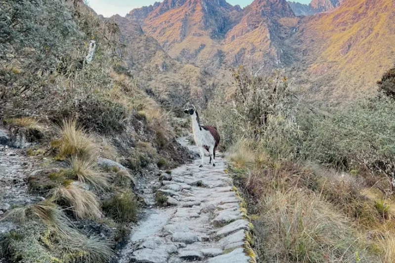
Second, the Inca built without many technologies associated with other ancient road systems. They did not rely on wheeled vehicles for transport, and they did not use draft animals like horses or oxen. Llamas carried some goods, but much transport depended on human labor, since roads were designed for walkers, runners, caravans, and state movement rather than carts.
Third, the engineering was highly adapted to place and terrain. In mountainous areas, roads might include stone steps, retaining walls, and drainage features. In sandy coastal zones, markers and cleared paths helped guide travelers, while across rivers, suspension bridges made from woven fibers connected routes that would otherwise be cut off entirely.
Fourth, the system required ongoing maintenance from surrounding communities. Roads, bridges, and way stations had to be repaired regularly, and communities along the route contributed labor to keep the network usable. This organization shows the administrative strength of the Inca state as much as its engineering skill.
Finally, the roads were integrated with other infrastructure across the empire. They connected storehouses, administrative centers, agricultural terraces, ritual places, and settlements. The Qhapaq Ñan was not isolated from daily life; it was woven into the empire’s economic, political, and spiritual systems.
What Was Significant About Inca Roads?
The question what was significant about Inca roads goes beyond construction techniques alone. Their significance lies in how they changed the relationship between people, power, and landscape across the Andes over time.
The roads made distance manageable in ways previously unavailable. They turned mountains and deserts from barriers into corridors, allowing a ruler in Cusco to project authority over lands hundreds or thousands of miles away. They helped create a shared imperial geography across regions with different languages, customs, climates, and resources.
Inca roads were also significant because they reflected Andean values of reciprocity, labor, and connection. Road construction and maintenance depended on organized community labor, and the system linked local responsibilities to imperial goals, making infrastructure a visible expression of political order.
The roads also reveal the Inca ability to absorb and standardize existing knowledge. Earlier paths were incorporated into the imperial system, while new sections were built to serve strategic needs. This combination of inherited knowledge and state planning is one of the defining features of the Qhapaq Ñan.
The Relationship Between the Qhapaq Ñan and the Inca Trail
Many travelers know the term Inca Trail because of the famous trekking route to Machu Picchu. That route is one of the best-known surviving sections associated with Inca road building, but it represents only a small part of the larger Qhapaq Ñan.
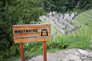
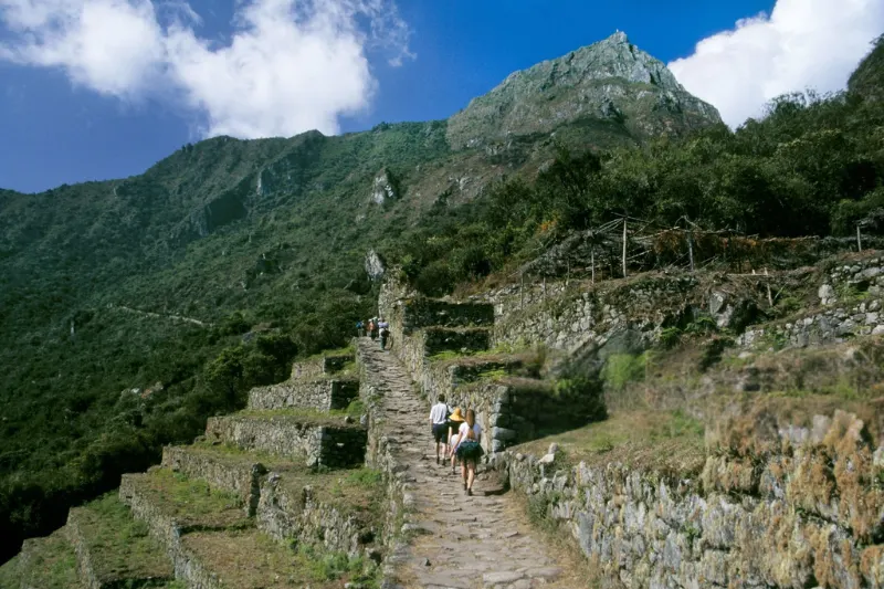
The classic Inca trail to Machu Picchu passes through cloud forest, mountain passes, archaeological sites, and stone paths before reaching the famous citadel. Its popularity has helped introduce millions of people to Inca engineering, though the broader Qhapaq Ñan extended far beyond Machu Picchu and connected a much larger world.
Understanding this distinction matters for anyone studying the system. The Inca Trail is a remarkable experience and an important heritage route, but the Qhapaq Ñan was an empire-wide system that linked major centers, provincial towns, ritual places, and resource zones across six modern countries. In other words, the Inca Trail is part of the story, but the Qhapaq Ñan is the bigger historical framework.
Engineering Features of the Qhapaq Ñan
The Qhapaq Ñan shows a deep understanding of terrain, climate, materials, and movement. Its engineering varied by region, but several features appear consistently across many sections of the network.
Stone Pavement
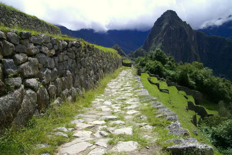
In mountain areas, roads were often paved with stone to create a stable surface. Stonework helped prevent erosion and made routes easier to maintain in wet or steep conditions. Some sections still show carefully fitted stones that have survived centuries of exposure to the elements.
Stairways
Where slopes were too steep for ordinary paths, builders created stairways instead. These could climb mountain ridges, descend into valleys, or connect terraces and settlements. For travelers on foot, stairs were often more practical than long switchbacks.
Retaining Walls
Retaining walls supported roads along steep hillsides and protected them from collapse over time. These walls also helped define the road corridor and stabilize vulnerable sections of the route.
Drainage Systems
In rainy regions, drainage was essential to the road’s survival. Channels, raised roadbeds, and carefully graded surfaces helped move water away from the path, preventing washouts and reducing long-term damage to the structure.
Bridges
The Inca built different types of bridges depending on the setting. Suspension bridges made from woven plant fibers were especially important in deep canyons and over fast-moving rivers. These bridges required regular renewal and community labor, showing again that the road system was both physical infrastructure and social organization.
Tambos and Storehouses
Along the roads, travelers encountered tambos, or way stations, where officials, messengers, and authorized travelers could rest. Nearby storehouses held supplies for state use. These facilities turned the road into a functioning network rather than a simple path.
Life Along the Road
The Qhapaq Ñan shaped the daily lives of people who lived near it in significant ways. Communities maintained local sections, supplied labor, hosted travelers, and interacted with officials moving through the region regularly. For some, the road brought obligations; for others, it offered access to goods, news, ceremonies, and state resources.
The road could be a sign of opportunity and control at the same time. It linked communities to a larger political system, but it also made imperial power more present in daily life. Soldiers, administrators, messengers, and labor groups all moved along the same arteries.
This dual character is important to understand. The Inca road system was impressive because it connected people, but connection was not neutral. It served the goals of the state while also shaping local economies and cultural exchange.
The Qhapaq Ñan as a UNESCO World Heritage Site
This Qhapaq Ñan Andean Road System is recognized as aUNESCO World Heritage Site because of its outstanding cultural value. The designation highlights selected sections across multiple countries, reflecting the road’s international importance and its shared Andean heritage.
Unlike a single monument or city, the Qhapaq Ñan is considered a cultural landscape. Its value comes from roads, associated archaeological sites, communities, natural settings, and continuing traditions. Protecting it requires cooperation across borders and attention to both physical preservation and living heritage.
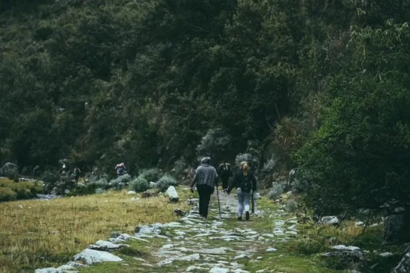
As one of the most important Andean UNESCO sites, the Qhapaq Ñan helps broaden how people think about world heritage more broadly. It is not only a ruin to be viewed from a distance. It is a network that still passes through inhabited landscapes, where local communities remain central to its meaning and future.
How the Road System Helped the Inca Empire Expand
The growth of the Inca Empire depended on strategy as well as conquest. Roads helped expansion in several distinct ways throughout the empire’s history.
First, they allowed armies to move into new territories and remain supplied along the way. Second, they helped administrators establish control after conquest was complete. Third, they connected newly incorporated regions to Cusco and to other parts of the empire. Fourth, they made it easier to relocate labor, distribute goods, and organize state projects efficiently.
Roads also communicated power visually to those who traveled them. A well-built imperial road, especially one connected to storehouses, administrative centers, and ceremonial spaces, signaled that the Inca state had arrived. Infrastructure itself became a message: the empire could organize labor, reshape landscapes, and bind distant places into a larger order.
Comparing the Qhapaq Ñan With Other Ancient Road Systems
The Qhapaq Ñan is often compared with Roman roads because both systems helped large empires communicate, move armies, and govern territory effectively. The comparison is useful, but the differences are just as important to understand.
Roman roads were often designed for wheeled vehicles and built across parts of Europe, North Africa, and western Asia. The Inca roads were designed primarily for foot traffic and pack animals in the steep, high-altitude environments of the Andes. Rather than emphasizing carts or wagons, the Qhapaq Ñan emphasized human movement, relay communication, and adaptation to dramatic vertical landscapes.
This makes the Inca achievement distinct from other ancient systems. The road system succeeded not by copying a universal model but by solving Andean problems with Andean knowledge specifically.
What Happened to the Qhapaq Ñan After the Spanish Conquest?
After the Spanish conquest in the 16th century, parts of the Inca road system continued to be used, while others declined, were modified, or were replaced by colonial routes. Spanish authorities used some existing roads for travel, administration, and extraction, but the system’s original political structure was broken in the process.
Over time, many sections were damaged by neglect, new construction, erosion, agriculture, mining, urban growth, and changes in transportation methods. Yet the road never disappeared completely. In some regions, local communities continued using sections for travel, herding, pilgrimage, and daily movement.
Today, archaeologists, conservationists, governments, and Indigenous communities work to document and protect surviving portions of the network. The challenge is complex because the Qhapaq Ñan crosses modern national borders and includes both remote archaeological areas and living communities.
Visiting Sections of the Ancient Road
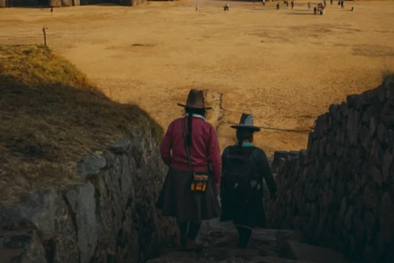
For many travelers, walking a section of Inca road is the most direct way to appreciate its scale and craftsmanship firsthand. The famous Inca trail to Machu Picchu is the best-known option, but it is not the only place where visitors can encounter the Qhapaq Ñan.
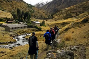
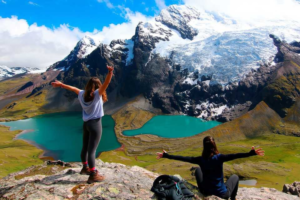
Depending on the country and region, travelers may find preserved road sections near archaeological parks, mountain communities, former administrative centers, or heritage landscapes. Beyond the classic route, alternatives like the Salkantay trek, the Lares trek, the Ausangate trek, and the Choquequirao trek also pass through sections connected to this ancient network, each offering a different way to experience the Andes and its living communities.
Some routes require permits or guided access, especially in heavily visited areas, while others are less developed and may require local knowledge, careful planning, and respect for community rules.
Responsible visits should prioritize preservation above all else. Ancient roads can be damaged by erosion, overcrowding, litter, and off-trail walking. Visitors should follow local guidance, avoid removing stones or artifacts, respect sacred places, and remember that many heritage landscapes are also home to living communities.
Why the Qhapaq Ñan Still Matters
The Qhapaq Ñan still matters because it challenges simple ideas about ancient technology and what counts as advanced infrastructure. It proves that sophisticated infrastructure does not require modern machines, wheeled transport, or written documents in the familiar sense, but rather knowledge, organization, environmental understanding, and social coordination.
The road system also matters because it preserves a broader Andean story across time. It connects the Inca Empire to earlier cultures and to present-day communities, showing continuity as well as change. Many people still live near, walk along, or maintain relationships with landscapes shaped by the ancient road.
For historians, the Qhapaq Ñan offers insight into empire, labor, communication, and engineering. If your are a traveler, it offers a powerful way to experience Andean geography firsthand. For Indigenous communities, it can represent heritage, identity, memory, and responsibility. For the world, it is a reminder that infrastructure can be both practical and deeply cultural.
Key Takeaways
The Qhapaq Ñan was the great Inca road network that connected the four regions of Tawantinsuyu from the imperial center of Cusco. It incorporated older Andean routes and expanded them into a vast system of roads, bridges, stairways, way stations, and storehouses.
The road system was important because it made communication, administration, military movement, resource distribution, and ceremonial life possible across a huge and difficult landscape. It was used by messengers, soldiers, officials, laborers, pilgrims, and communities throughout the empire.
What was significant about Inca roads was not only their size but their integration with politics, religion, economy, and geography. They helped transform the Andes into a connected imperial space while reflecting centuries of local knowledge.
The Qhapaq Ñan remains one of the world’s most remarkable ancient road systems. Whether approached through archaeology, history, travel, or heritage preservation, it stands as a lasting example of Andean ingenuity and the enduring power of connection.