You’ve probably seen those photos. The ones that look like someone ran a perfectly normal mountain through every filter available, pinks that don’t exist in nature, cyans that belong on a screensaver, gradients that make the whole thing look like a fever dream someone turned into a postcard. And then you typed «where are the rainbow mountains» into a search bar and ended up here. Good.
This guide gives you the actual answer, starting with the location of the rainbow mountain that most people are asking about: Vinicunca, somewhere deep in the Peruvian Andes southeast of Cusco. More interesting than the filtered version anyway, and considerably more useful than anything the algorithm is currently pushing at you.
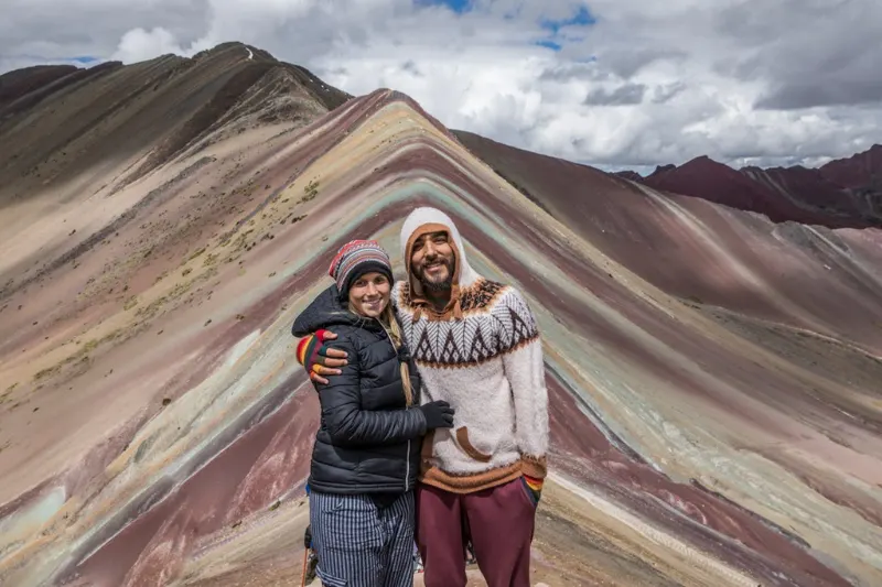
Nature rarely does electric cyan or glowing magenta. What’s actually out there is iron that spent millions of years rusting into terracotta red, ancient sulfur leaving behind streaks of mustard yellow, minerals doing their slow work across geological time. Standing in front of it in person is a different experience than the photos suggest, quieter somehow, and in most ways better.
Summary
Peru’s Rainbow Mountains sit in the Andes southeast of Cusco, Vinicunca being the one everyone photographs and Palccoyo being the one people who’ve done both tend to quietly recommend. Colors are real, just earthier than Instagram suggests. Two acclimatization days, dry season timing, early start. Pick the route that matches your lungs and your tolerance for crowds.
Conquering Vinicunca: How to Navigate Peru’s Most Famous Multi-Colored Peak
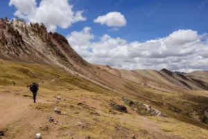
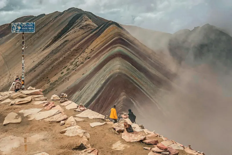
Where are the rainbow mountains, exactly. For most people asking, the answer starts and ends with Vinicunca, a mountain in the high Peruvian Andes that went from unknown to overrun in about three years once the photos hit social media. It sits at 5,200 meters, which sounds like a statistic until you’re standing there and realize your body has opinions about that number that your brain didn’t anticipate.
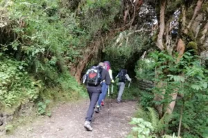
The day starts aggressively early. Around 3am departure from Cusco if you’re on a guided tour, which is the only way to get ahead of the buses that otherwise make the viewing platform feel like a crowded subway car at high altitude. Breakfast somewhere lower down around 6am, trailhead around 7:30, and then the hike itself, which is how long hike to rainbow mountain Vinicunca people always want to know before they commit. Two hours up, more or less, depending entirely on how well acclimatized you are and whether your body decides to cooperate.
The trail grade isn’t the issue. The altitude is doing most of the work against you. Sections that would register as flat on any normal hiking day feel like something else at 5,000 meters. The final push to the ridge is genuinely steep and that’s where the gap between people who acclimatized and people who didn’t becomes very obvious very fast.
Beating the Crowds at Palccoyo: The Secret 3-Mountain Alternative to Vinicunca
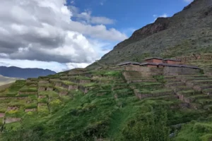
Most operators don’t volunteer this but Vinicunca isn’t actually the only answer to where are the rainbow mountains. Palccoyo sits in the same broader region, shows you three striped ridges instead of one, includes the Red Valley, and the main viewpoint involves about 45 minutes of walking on terrain that’s mostly flat. It exists, it’s real, and the people who find it tend to feel like they discovered something.
The comparison that gets less airtime than it should is humantay lake vs rainbow mountain Vinicunca, because travelers doing their research get stuck choosing between famous things and miss that Palccoyo is sitting right there as a third option worth serious consideration. Fewer buses, more physical space, a view that spans multiple ridges simultaneously. The trade-off is that nobody’s heard of it, which depending on your priorities is either a problem or the whole point.
The Red Valley is a genuine addition to the Palccoyo experience, not a consolation prize. Deep iron deposits create a landscape that reads almost Martian against the striped peaks, burnt red stretching across the valley in a way that photographs badly and looks extraordinary in person. Comparing directly: Vinicunca is strenuous, iconic, shoulder to shoulder with strangers, one peak. Palccoyo is 45 minutes of easy walking, three peaks, Red Valley, a fraction of the crowds.
From Rust to Gold: Why These Mountains Change Color with the Weather
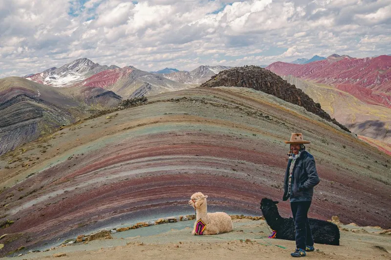
Where are the rainbow mountains getting their color from. Iron, mostly. The same oxidation process that ruins metal left outdoors has been running inside these mountains for millions of years, building thick layers of terracotta red through accumulated iron oxide. Sulfur deposits contributed mustard yellow. Manganese added darker purples. Different minerals from different geological periods, stacked horizontally the way sediment always stacks, and then the tectonic forces that built the Andes tilted those horizontal layers into steep angled ridges where all of them are suddenly visible at once.
There’s snow on rainbow mountain Vinicunca during the wet season, and that’s a real practical problem rather than just an aesthetic one. Fresh snowfall covers the mineral layers completely and you end up doing the full hike to look at a white hillside, which is a specific kind of frustrating that no travel blog adequately prepares you for. Wet rock actually helps in moderate amounts: a light shower saturates the porous surface and the reds and yellows come up noticeably richer than they read when everything is dry and dusty.
Midday sun washes the palette out regardless of season. The filters in viral photos exist because photographers were compensating for that gap between what the camera caught and what their eye actually saw standing there. The real colors are worth seeing. They’re just not neon, and that expectation gap is the thing that trips people up more than the altitude does.
Staying Safe at 17,000 Feet: A Proven Strategy for Altitude and High-Altitude Gear
You step out of the vehicle at 5,200 meters and your lungs immediately start filing a complaint. Sorojchi is the Andean word for altitude sickness and at this elevation it’s not a fringe outcome, it’s the default if you haven’t given your body time to adjust before asking it to hike. Unlike the crowds at Machu Picchu, which you can outmaneuver with smart timing, altitude doesn’t respond to planning. It responds to biology and biology runs on its own schedule.
Two full days in Cusco before the trek. Not one, not a night, two days of actual acclimatization with light movement and real rest. Coca leaf tea gets offered at most trailhead stops and deserves to be taken seriously rather than treated as local color, the alkaloids genuinely blunt mild altitude symptoms in ways that aren’t placebo. Some people carry small supplemental oxygen cans and nobody who’s used one at 5,200 meters has ever described it as unnecessary.
Temperature swings on a day like this are wider than people expect coming from lower elevations. Freezing before dawn at the trailhead, potentially warm enough to shed layers by mid-morning, cold again on the descent. The layering system exists because you’ll be adding and removing clothing multiple times and what keeps you comfortable changes faster than the view does.
Packing the right gear makes a real difference:
- Moisture-wicking base layer: Synthetic or merino only, cotton holds moisture against skin and becomes a cold problem the moment wind picks up.
- Insulating mid-layer: Fleece or packable down that actually performs when you stop moving at the viewpoint and the wind finds you.
- Windproof outer shell: A lightweight rain jacket because mountain mist appears without warning and the wind up here has opinions.
- High-altitude accessories: Trekking poles for the steep descent sections, SPF 50 minimum because UV at this elevation is a different category than what most people are used to.
Your Painted Mountain Roadmap: Selecting and Planning Your High-Altitude Adventure
Where are the rainbow mountains in terms you can actually use for planning: southeast of Cusco in the high Peruvian Andes, Vinicunca as the famous and demanding option, Palccoyo as the accessible and underrated one. The location of the rainbow mountain matters less at this point than the question of which version of this experience you’re actually built for right now.
Dry season runs May through October and there isn’t a meaningful argument for another window. Rainy season produces mud, snow that buries the color entirely, and the kind of visibility that makes the whole exercise academic. Vinicunca in dry season with a 3am departure from Cusco and two real acclimatization days behind you is the formula. Palccoyo similarly seasonal window with a more reasonable start time is the alternative that suits a larger percentage of travelers than the tour operators tend to advertise.
Get a certified local guide as logistics on both routes involve variables that can affect independent travelers who underestimate conditions and planning in remote areas. A guide who knows the region manages those variables early, helping you understand real conditions instead of relying only on what popular photos suggest.
Frequently Asked Questions
Where are the rainbow mountains located in Peru?
Vinicunca, the most famous, sits in the high Andes southeast of Cusco and works as a full-day trip from the city with early start. Palccoyo is in the same region and offers three striped peaks plus the Red Valley on a gentler walk with fewer crowds than Vinicunca daily.
Are the colors as neon as the photos online?
No, and expecting neon is the thing that most reliably ruins the experience. What’s actually there is rich and earthy: terracotta reds, mustard yellows, greens and purples that shift depending on light and moisture. Early morning on a clear dry season day with slightly damp rock from overnight moisture is about as good as it gets without a filter.
When should I visit and how do I deal with crowds and weather?
May through October dry season only, with 3am departures from Cusco for Vinicunca if the viewpoint crowd matters to you. Palccoyo allows a later start, sees far fewer buses, and gives you more to look at from the main ridge. Wet season means snow covering the color and mud making the approach genuinely unpleasant.
How hard are the hikes and what do I need for altitude?
Vinicunca reaches 5,200 meters and the trail earns its difficulty from elevation rather than technical terrain, with the final ridge push being the steepest section. Palccoyo is mostly flat but still sits high. Two full acclimatization days in Cusco, coca leaf tea at the trailhead, layers, trekking poles, SPF 50, and realistic expectations at altitude.