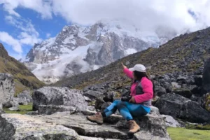
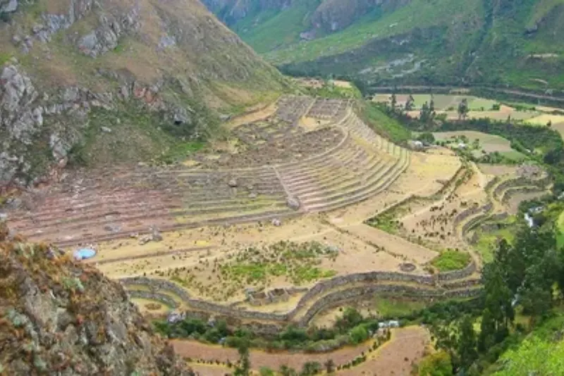
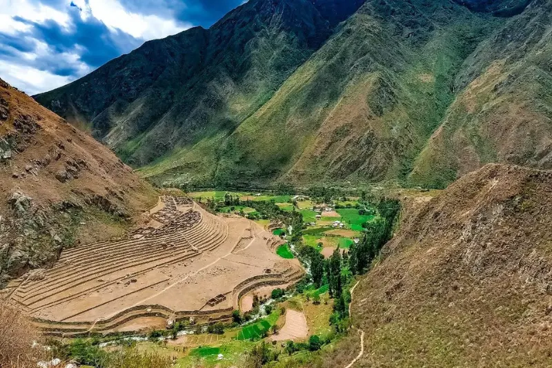
Day one on the Classic Inca Trail feels like a slow approach march to most people. Sun overhead, valley wide open, farmland slowly turning into stonework underfoot. Llactapata, also written Llaqtapata, interrupts that rhythm without warning. Perched above the Urubamba Valley near the trailhead, this is one of the first archaeological sites on the route. A quiet introduction to how the Incas handled space, water, and labor before anything famous comes into view.
Not one dramatic ruin. A small complex, terraces, building foundations, pathways, all pointing toward a working landscape combining agriculture with administrative presence, tied into the larger Qhapaq Ñan road network. Llactapata peru changes how the rest of the route reads once visited early. Sightlines, slopes, river corridors all start registering as deliberate rather than incidental from here on.
Where Llactapata Sits on the Classic Inca Trail
The inca trail begins around Km 82 and climbs toward the first camps. Llactapata gets visited Day 1, before the trail commits to higher passes. Close enough that legs still feel fresh. Far enough that the valley genuinely opens up and the scale of things becomes visible for the first time on the trek.
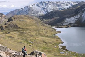
The Urubamba River below isn’t scenery. Natural artery linking ecological zones, concentrating movement through the valley. A settlement above it gains oversight, arable land access, connection to other points on the road network.
Llactapata introduces a central theme of Inca planning early, controlling circulation of people, food, water, information through geography itself. Climate impact on the inca trail shows here too. Microclimates shift between terrace levels in ways the Incas clearly understood long before anyone had a term for it.
Reading the Site: Terraces, Foundations, and a Working Landscape
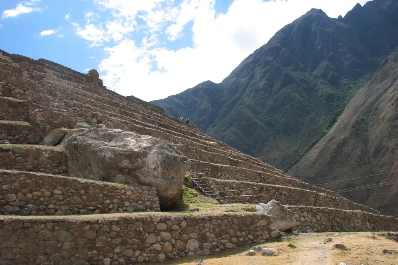
Terracing is the most visible feature. Not simple planting steps. Stone retaining walls stabilize slopes, manage drainage, create warmer or cooler microclimates depending on orientation and airflow. In the Urubamba Valley’s variable conditions, terraces function as environmental engineering as much as agriculture.
Building platforms and partial wall lines near the terraces suggest multiple functions. Storage, housing for workers or administrators, spaces tied to the agricultural calendar. Llactapata rewards contextual observation over searching for one dramatic monument.
Perspective from Llactapata is genuinely underrated. Looking across the valley toward the river corridor places the early trail into a wider map. The trek starts feeling like a network instead of a line. Biodiversity of the inca trail becomes apparent from this exact vantage point, terraced slopes supporting different plant communities at each elevation band, visible as distinct color bands across the hillside.
Llactapata in the Qhapaq Ñan: Why the Incas Built Here
The name itself is a starting point. Llaqta broadly means place or settlement, similar names show up across the Andes at multiple sites. What distinguishes this particular Llactapata is its role within the Classic Inca Trail’s valley segment specifically. Elevation provides oversight without the exposure higher ridge locations carry, while staying close to productive land and the river’s transport corridor.
A complex like Llactapata functioned as part of a layered system. Agricultural production supported travelers and nearby populations. Storage and distribution reduced risk during unpredictable seasons. Built presence reinforced state authority in a strategically important valley. Inca infrastructure rarely served just one purpose. A terrace means food security but also taxation capacity. A path means a route but also a boundary and a signal of control.
Water management is the quieter clue running through Llactapata. Channels and masonry don’t need to look dramatic for the siting of terraces and structures to reflect real understanding of runoff patterns and seasonal flow. On steep Andean slopes, controlling water means controlling whether the whole settlement remains viable over time.
How to Experience Llactapata on the Inca Trail
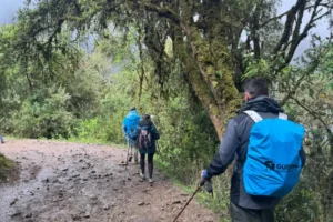
Llactapata sits inside the regulated inca trail corridor, so the reliable way to visit is through an authorized trek with a permitted operator and guide. What regulations should you know before visiting the inca trail starts with the permit system. Required for the Classic Inca Trail, capped daily, date-specific once booked and not transferable. A knowledgeable guide makes a real difference too, pointing out terrace lines, construction differences, sightlines easy to miss when focus stays on distance and pace alone.
Treating Llactapata as more than a photo stop means arriving with time to slow down, drink water, and look for patterns:
- Orientation: Which direction do terraces face, and what does that say about sun exposure and temperature management?
- Connectivity: Where do paths lead, and what does that suggest about how movement was organized through the site?
- Function: Which areas look suited to storage or residence versus active cultivation?
First day’s lower elevation doesn’t remove the need for discipline. Sun exposure runs intense and early enthusiasm causes overpacing more than people expect on what looks like an easy day.
Managing rhythm here, steady steps, consistent hydration, short controlled breaks, sets up the harder ascents later. Coca leaf tea at the first rest stop is worth taking even on day one. The body benefits from starting the habit early rather than waiting until altitude becomes a real problem higher up.
Photography, Respect, and Preservation
Llactapata’s appeal runs on subtlety. Not saturated with crowds the way later checkpoints can be, and the landscape setting is genuinely part of the artifact rather than backdrop for it. Wide framing including terraces and valley geometry works better than tight shots of individual stones. Morning light flatters the site particularly well, though even in brighter conditions the terrace lines read clearly as long repeating contours across the hillside.
Preservation here is straightforward. Stay on established paths, avoid climbing on walls, treat loose stones as part of the site’s structure rather than souvenirs to pocket. These ruins survived through a careful balance of stone, soil, and slope across centuries. Unnecessary pressure and off-trail foot traffic accelerate erosion in ways that don’t reverse easily once started.
Why Llactapata Matters Before the Rest of the Trail
The Classic Inca Trail often gets narrated backward, from the destination outward, which makes early sites feel like prologues rather than places worth attention on their own terms. Llactapata deserves better. A lesson in the practical genius of the Inca state, systems integrating agriculture, movement, and authority directly into the terrain itself rather than imposed on top of it.
Learning to read Llactapata, its terraces, its vantage point, its quiet internal logic, changes how the entire trail reads from that point forward. Step by step, long before the famous stones appear, llactapata peru sets the framework for understanding everything that follows.
Essential foods for the inca trail also make more sense once the agricultural function here is understood. The quinoa, potatoes, and corn fueling trekkers today trace directly back to crops grown on terraces exactly like these centuries ago.